

Welcome To The Danvers Rail Trail
From Rails To Recreation
The Danvers Rail Trail Aerial Maps
For more information on each trail segment, hover your mouse over the image. For a large scale photo, just click on the image. Printable trail map - For a large PDF view of the map which you can print, please click here!

Characterization: 0.55 miles This segment of the Rail corridor right-of-way (ROW) begins at Walmart continuing north across Route 114 to Prince Street and is primarily adjacent to industrial/commercial neighborhoods. Access to the trail corridor is gained from both the east and west by climbing steep, brush covered slopes.
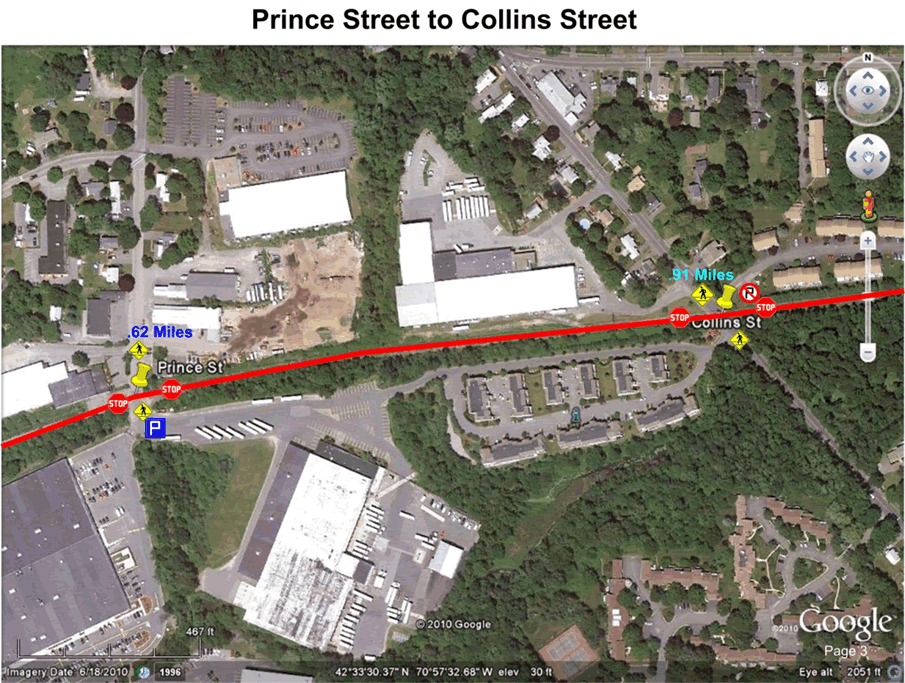
Characterization: 0.3 miles This segment’s western portion, consists of commercial properties while the east side is shared with a large condominium complex and parking area used for truck storage.
Characterization: 0.4 miles The majority of the segment’s eastern portion, outside the trail corridor, consists of woodlands containing vernal pools that are often flooded during the spring. The western portion contains several high density housing structures and a large recreation area including ball fields. (Tapley Park) ( Rebecca Nurse)
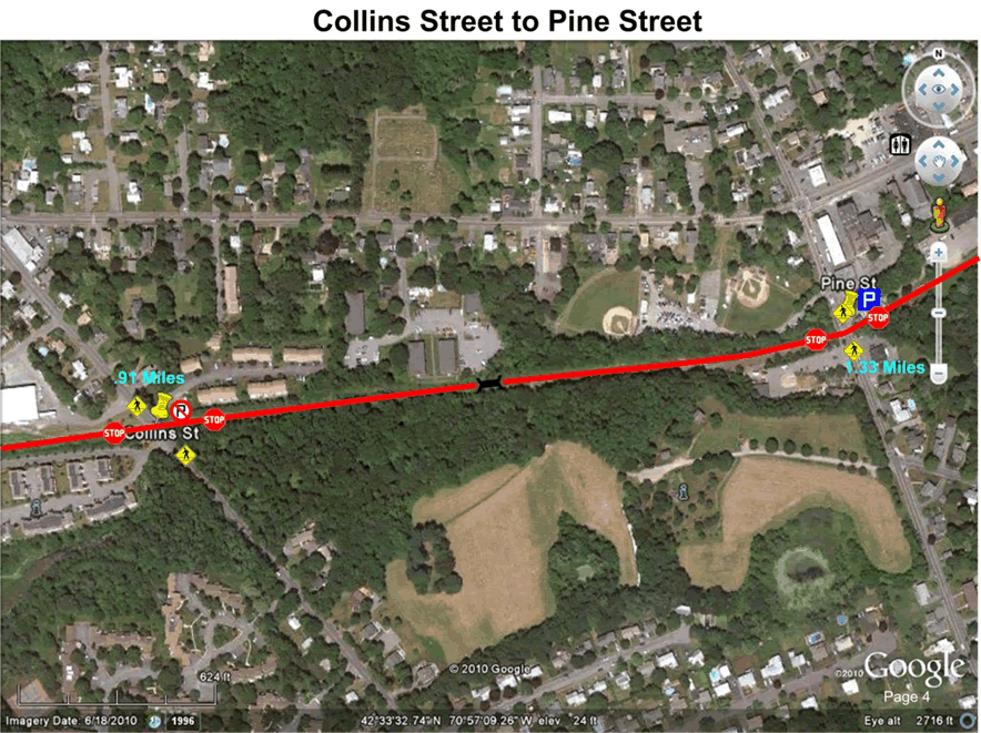
Characterization: 0.25 miles This segment provides a direct route to Tapley field from the downtown area.
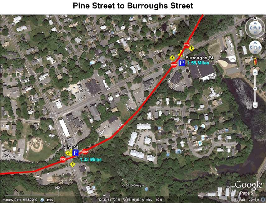
Characterization: 0.25 miles Both sides of this segment have many residential structures in close proximity to the trail. Provides connection to the Meadows.

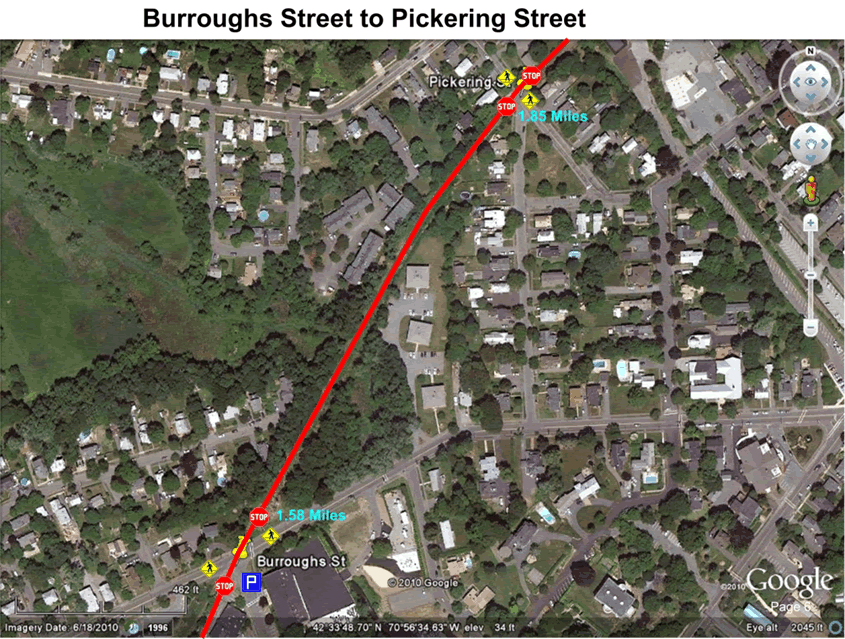
Characterization: 0.2 miles This segment is immediately adjacent to a large parking lot that will be used as a main access point for the trail. Intersects with an east/west railroad right-of-way
Characterization: 0.1 miles This segment is within the downtown area adjacent to many retail businesses.

Characterization: 0.1 miles This segment is a residential area with access to downtown business district.
Characterization: 0.1 miles This segment of the trail corridor is fenced along both sides preventing access from adjacent properties along the entire stretch.

Characterization: 0.15 mile This segment of the trail corridor is primarily fenced along both sides.
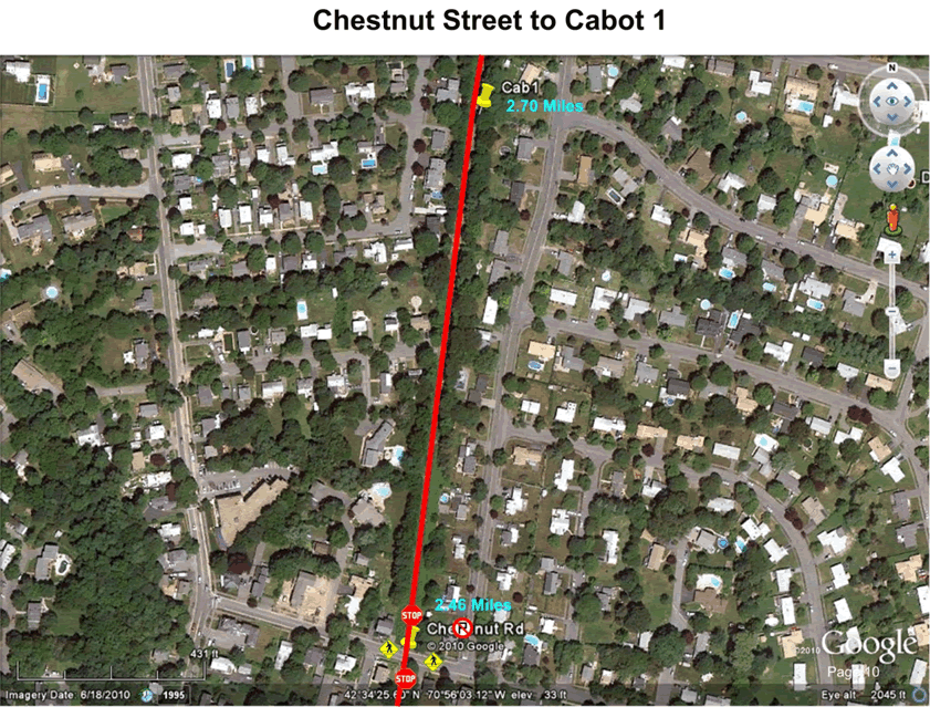
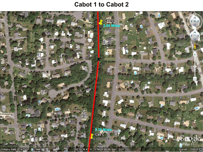
Characterization: 1.0 mile Many areas along the eastern portion this segment of the corridor have very steep slopes, which poses a challenge to trail access from adjacent properties and a potential safety issue. This sloping also creates a lack of privacy for adjacent properties. This eastern portion transforms into woodlands after the High School and contains a small pond. The west side of this segment before the school has many residential structures in close proximity to the trail.
Characterization: 1.0 mile Many areas along the eastern portion this segment of the corridor have very steep slopes, which poses a challenge to trail access from adjacent properties and a potential safety issue. This sloping also creates a lack of privacy for adjacent properties. This eastern portion transforms into woodlands after the High School and contains a small pond. The west side of this segment before the school has many residential structures in close proximity to the trail.

Characterization: 1.0 mile Many areas along the eastern portion this segment of the corridor have very steep slopes, which poses a challenge to trail access from adjacent properties and a potential safety issue. This sloping also creates a lack of privacy for adjacent properties. This eastern portion transforms into woodlands after the High School and contains a small pond. The west side of this segment before the school has many residential structures in close proximity to the trail.

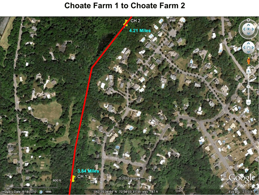
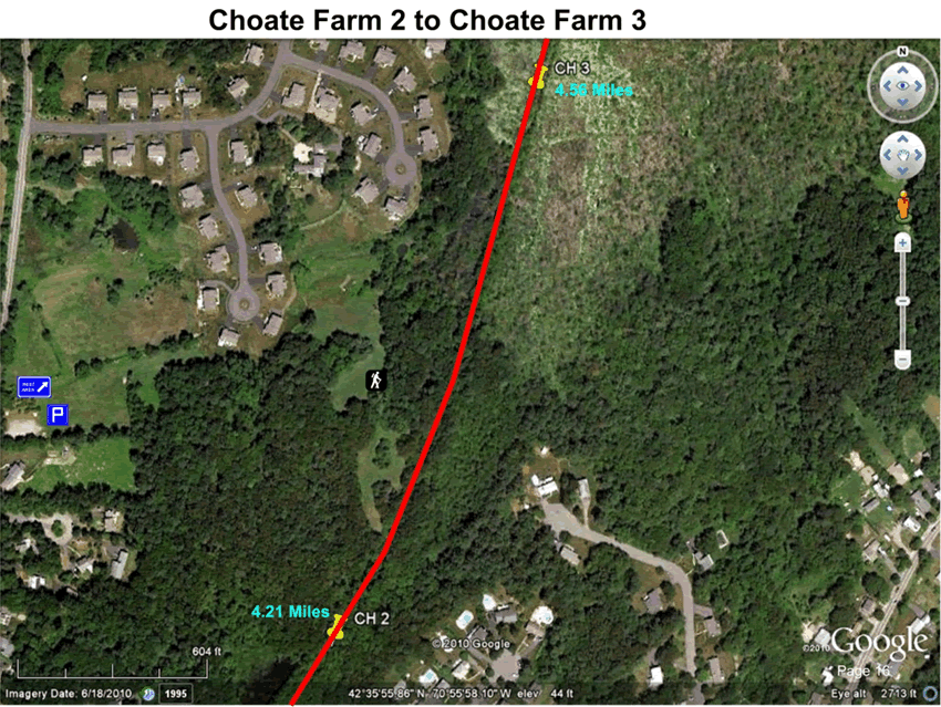
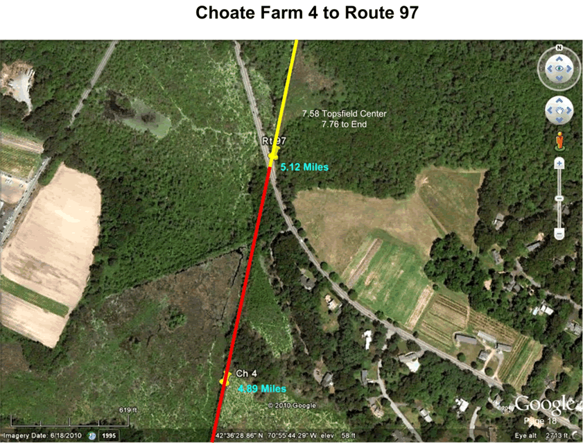
Characterization: 1.25 miles The majority of the segment’s eastern portion, outside the trail corridor, consists of rising and falling topography, while the western portion, outside the trail corridor, is generally level. According to the National Wetland Inventory (NWI) map, this segment has areas of a palestine, forested, broad-leaved deciduous, periodically flooded wetlands. This trail is the Swampwalk entry point, and has access to Choate Farm meadows and hiking trails,and connection north

Characterization: 1.25 miles The majority of the segment’s eastern portion, outside the trail corridor, consists of rising and falling topography, while the western portion, outside the trail corridor, is generally level. According to the National Wetland Inventory (NWI) map, this segment has areas of a palestine, forested, broad-leaved deciduous, periodically flooded wetlands. This trail is the Swampwalk entry point, and has access to Choate Farm meadows and hiking trails,and connection north
Characterization: 1.25 miles The majority of the segment’s eastern portion, outside the trail corridor, consists of rising and falling topography, while the western portion, outside the trail corridor, is generally level. According to the National Wetland Inventory (NWI) map, this segment has areas of a palestine, forested, broad-leaved deciduous, periodically flooded wetlands. This trail is the Swampwalk entry point, and has access to Choate Farm meadows and hiking trails,and connection north
Characterization: 1.25 miles The majority of the segment’s eastern portion, outside the trail corridor, consists of rising and falling topography, while the western portion, outside the trail corridor, is generally level. According to the National Wetland Inventory (NWI) map, this segment has areas of a palestine, forested, broad-leaved deciduous, periodically flooded wetlands. This trail is the Swampwalk entry point, and has access to Choate Farm meadows and hiking trails,and connection north

Characterization: 1.25 miles The majority of the segment’s eastern portion, outside the trail corridor, consists of rising and falling topography, while the western portion, outside the trail corridor, is generally level. According to the National Wetland Inventory (NWI) map, this segment has areas of a palestine, forested, broad-leaved deciduous, periodically flooded wetlands. This trail is the Swampwalk entry point, and has access to Choate Farm meadows and hiking trails,and connection north
Characterization: 1.25 miles The majority of the segment’s eastern portion, outside the trail corridor, consists of rising and falling topography, while the western portion, outside the trail corridor, is generally level. According to the National Wetland Inventory (NWI) map, this segment has areas of a palestine, forested, broad-leaved deciduous, periodically flooded wetlands. This trail is the Swampwalk entry point, and has access to Choate Farm meadows and hiking trails,and connection north